Our Database
Europe
Our datamodel combines a near-complete database of 20 million + Points of Interest across Europe with rich geospatial layers of economic and demographic data.
Unmatched Granularity
Discover GeoPulse’s powerful POI database, featuring over 20 million geocoded locations across 34 European countries. Each data point is meticulously classified into 12 main groups, 144 industries, and 600 detailed subcategories—giving you unmatched granularity and insight. Whether you’re optimizing location intelligence or enhancing market analysis, our structured taxonomy makes it easy to target exactly what you need. View our full category breakdown to see the depth of our data.


Pan‑European Precision
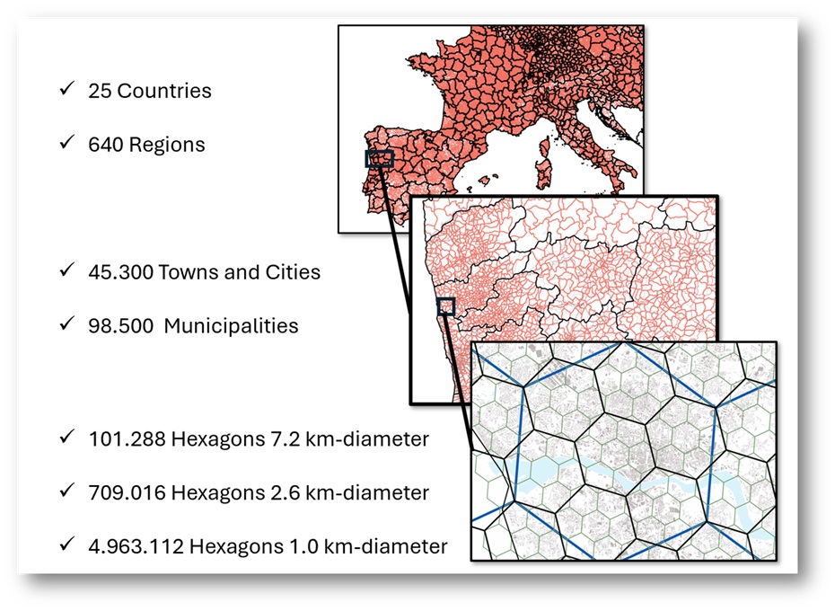
Our database is structured according to Eurostat’s geographic granularity, covering 34 countries divided into regions, sub‑regions and municipalities. At the most detailed level, each area is enriched with a wide range of demographic and economic indicators, enabling precise market intelligence and powerful location‑based analysis.
Urban Data Grid
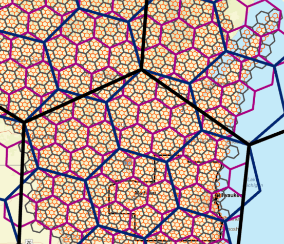
GeoPulse enriches its POI database with high‑resolution demographic and economic data using the H3 spatial index. Across Europe, over 2.5 million 800‑meter hexagons provide granular metrics such as population, income and housing values. This hyperlocal framework enables precise analysis and benchmarking across comparable H3 units for deeper market insights.
Spatial Patterns
By fusing these datasets, we uncover deep spatial patterns and correlations. This enables detailed analysis of both individual POIs and broader regional or urban dynamics. From micro-locations to entire cities, Geopulse delivers the insights needed to understand, compare and strategize with precision.
Europes largest structurised Geo-Database
Our Database
At Geopulse, our datamodel combines a near-complete database of 20 million + Points of Interest across Europe — including stores, restaurants, transit hubs and services — with rich geospatial layers of economic and demographic data at the granular 400-meter H3 grid level.